Minnesota's Ecoregions and Growing Conditions
Welcome Back, Plant Explorers!
 Let's explore the prairie! In this chapter, we'll discover what makes
Minnesota's landscape so wonderfully diverse. From tallgrass prairies in the
west to boreal forests in the northeast, you'll learn why certain native
plants thrive in certain places — and how to match the right plant to your
own backyard.
Summary
Minnesota sits at a remarkable ecological crossroads. Three major North American biomes meet within our borders, creating a patchwork of prairies, forests, and wetlands found in few other states. This chapter explores Minnesota's ecoregions, climate zones, soils, and growing conditions. Understanding these factors is the key to choosing native plants that will thrive in your specific location.
Minnesota Ecoregions
An ecoregion is a large area of land defined by its climate, landforms, soils, and natural plant communities. Scientists use ecoregions to describe the major patterns of landscape and vegetation across a region.
Minnesota contains four major ecoregions:
- Tallgrass Prairie — the western and southwestern portion of the state
- Deciduous Forest — the central and southeastern regions
- Coniferous (Boreal) Forest — the northeastern corner and Boundary Waters area
- Prairie-Forest Border — the transition zone where prairie and forest intermingle
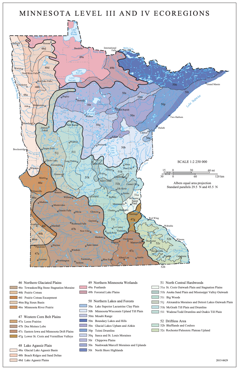 Map: EPA Level III Ecoregions of Minnesota. Source: U.S. Environmental Protection Agency (public domain).
The following diagram shows how Minnesota's ecoregions transition from west to east across the state, driven by increasing rainfall and changing fire frequency.
flowchart LR
    subgraph WEST["West -- Drier, Flatter"]
        TP["Tallgrass<br/>Prairie"]
    end
    subgraph CENTER["Central -- Transition"]
        PFB["Prairie-Forest<br/>Border<br/>(Oak Savanna)"]
    end
    subgraph EAST["East & South -- More Moisture"]
        DF["Deciduous<br/>Forest"]
    end
    subgraph NORTHEAST["Northeast -- Cold, Thin Soils"]
        CF["Coniferous<br/>(Boreal) Forest"]
    end

    TP -- "Increasing rainfall →" --> PFB
    PFB -- "Less fire, more trees →" --> DF
    DF -- "Colder, shorter season →" --> CF

    style TP fill:#FFECB3,color:#000
    style PFB fill:#DCEDC8,color:#000
    style DF fill:#C8E6C9,color:#000
    style CF fill:#B2DFDB,color:#000
Explore Minnesota's ecoregions interactively by clicking on different regions of the map to see their characteristic plants and growing conditions.
Minnesota Ecoregion Explorer
Type: microsim
Learning Objective: Students will understand the geographic distribution of Minnesota's four major ecoregions and the distinct plant communities, soil types, and climate conditions associated with each.
Controls: - Clickable map regions for each ecoregion - Toggle buttons to show/hide layers: dominant plants, soil types, annual rainfall
Visual Elements: - Simplified map of Minnesota divided into four color-coded ecoregions - Info panel displaying representative native plants, soil type, and climate data for the selected region - Plant illustrations or icons for key species in each ecoregion
Behavior: - Clicking a region highlights it and populates the info panel with ecoregion details - Toggling layers overlays additional data (rainfall gradient, soil type shading) on the map - Hovering over plant names shows a brief description
Instructional Rationale: Spatial learning through an interactive map helps students connect geographic location to ecological conditions, reinforcing why certain plants thrive in certain parts of the state.
These ecoregions did not appear randomly. They result from differences in rainfall, temperature, fire history, glacial landforms, and soils. Western Minnesota is drier and flatter, favoring grasses. Eastern and northern Minnesota receives more moisture and has hillier terrain, favoring trees.
The Minnesota Department of Natural Resources (DNR) further divides these four broad regions into smaller ecological subsections — 26 in total — each with its own distinctive character. The Anoka Sand Plain near the Twin Cities, for example, has sandy soils and dry prairies. The Border Lakes region near Ely has thin soils over bedrock and old-growth boreal forest.
Key Insight
 Every plant has a story! Minnesota is one of the only places in North
America where tallgrass prairie, deciduous forest, and boreal forest all
meet. This ecological crossroads gives us extraordinary plant diversity —
over 1,800 native species.
Tallgrass Prairie Region
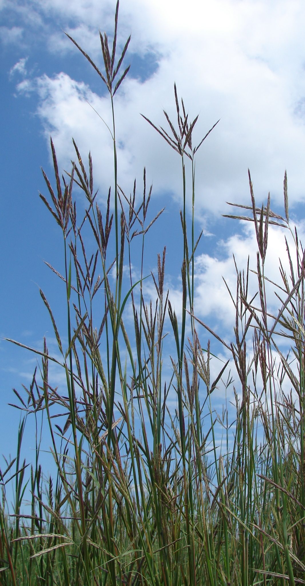 Big Bluestem (Andropogon gerardii), the signature grass of the tallgrass prairie, can reach 6 to 8 feet tall. Photo: Jennifer Briggs / USFWS (CC BY 2.0).
The tallgrass prairie once covered roughly one-third of Minnesota — about 18 million acres stretching across the western and southern parts of the state. Today, less than 2% of that original prairie remains, making it one of the most endangered ecosystems in North America.
What Defines Tallgrass Prairie
Tallgrass prairie forms where annual rainfall is moderate (20 to 35 inches), summers are warm, and periodic fire prevents trees from taking over. The "tallgrass" name comes from the dominant grasses, which can reach heights of 6 to 8 feet by late summer.
Key tallgrass prairie plants include:
- Big Bluestem (Andropogon gerardii) — The signature prairie grass, growing up to 8 feet tall with distinctive three-pronged seed heads that resemble a turkey foot
- Indian Grass (Sorghastrum nutans) — A graceful grass with golden, plume-like seed heads
- Prairie Dropseed (Sporobolus heterolepis) — A fine-textured bunchgrass with a sweet fragrance
- Purple Coneflower (Echinacea purpurea) — A beloved wildflower with pink-purple petals and a spiny central cone
- Black-eyed Susan (Rudbeckia hirta) — A cheerful yellow wildflower found throughout Minnesota prairies
What Lies Beneath
The true power of tallgrass prairie is underground. Prairie grasses send roots 10 to 15 feet deep into the soil. These massive root systems built the rich, dark topsoil that makes the Midwest such productive farmland. A single square yard of prairie soil can contain over 20 miles of roots.
Where to See Tallgrass Prairie Today
You can experience remnant and restored tallgrass prairie at several locations across Minnesota:
- Blue Mounds State Park near Luverne in the far southwest
- Glacial Lakes State Park near Starbuck in west-central Minnesota
- Bluestem Prairie (The Nature Conservancy) near Moorhead
- Schaefer Prairie (The Nature Conservancy) near Glencoe
Deciduous Forest Region
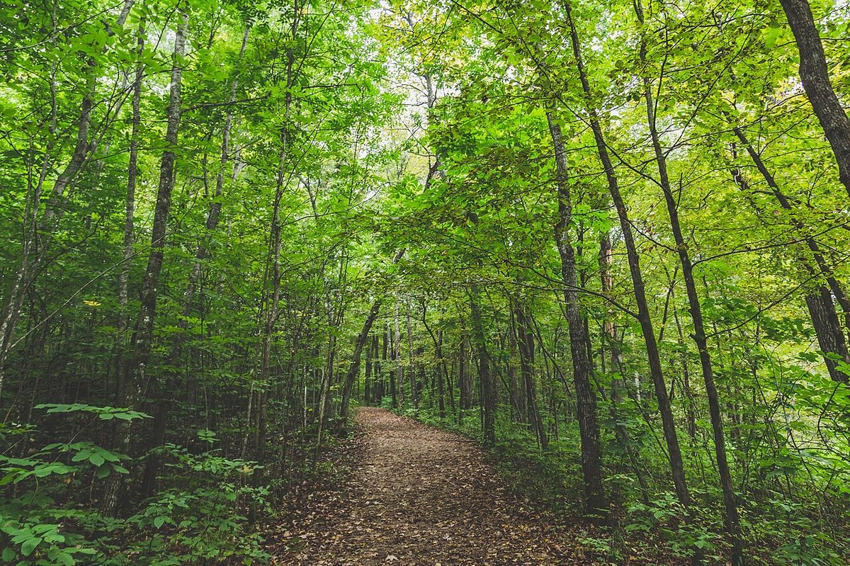 A hiking trail winds through the deciduous forest canopy at Nerstrand Big Woods State Park, one of the best remaining Big Woods remnants in Minnesota. Photo: Wikimedia Commons (CC BY-SA 2.0).
The deciduous forest region covers central and southeastern Minnesota. Deciduous means "falling off" — these are the hardwood trees that drop their leaves each autumn, painting the landscape in brilliant reds, oranges, and golds.
What Defines Deciduous Forest
Deciduous forests develop where rainfall is higher than on the prairie (30 to 35 inches per year) and where terrain provides enough shelter from fire to allow trees to grow. The soils tend to be rich, deep, and well-drained.
Minnesota's deciduous forests include a mix of tree species:
- Sugar Maple (Acer saccharum) — The source of maple syrup, with brilliant orange fall color
- Red Oak (Quercus rubra) — A tall, stately tree that produces acorns critical to wildlife
- American Basswood (Tilia americana) — A large shade tree with fragrant summer flowers beloved by bees
- White Birch (Betula papyrifera) — An iconic Minnesota tree with peeling white bark
- Ironwood (Ostrya virginiana) — A tough understory tree common in mature forests
The Forest Floor
Deciduous forests have a rich understory of shrubs and wildflowers. Because sunlight reaches the forest floor in spring before trees leaf out, many woodland wildflowers bloom early:
- Bloodroot (Sanguinaria canadensis) — One of the first spring wildflowers, with a single white flower
- Wild Ginger (Asarum canadense) — A ground-cover plant with heart-shaped leaves
- Jack-in-the-Pulpit (Arisaema triphyllum) — An unusual flower shaped like a hooded preacher in a canopied pulpit
Where to See Deciduous Forest
- Nerstrand Big Woods State Park in Rice County — one of the best remaining Big Woods remnants
- Whitewater State Park in the bluff country of southeastern Minnesota
- Frontenac State Park along the Mississippi River near Red Wing
Coniferous Forest Region
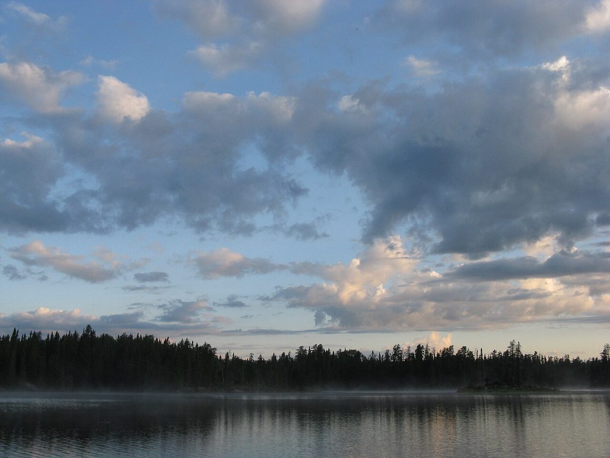 Boreal forest surrounds a lake in the Boundary Waters Canoe Area Wilderness, northeastern Minnesota. Photo: U.S. Forest Service (public domain).
The coniferous forest (also called the boreal forest) blankets northeastern Minnesota. Coniferous means "cone-bearing" — these are the evergreen trees that keep their needles year-round: spruces, pines, and firs.
What Defines Coniferous Forest
Coniferous forests develop where winters are long and harsh, summers are short, and soils are thin and acidic. Northeastern Minnesota has some of the coldest temperatures in the lower 48 states. The growing season may be as short as 90 days in the far north.
Key coniferous forest species include:
- White Spruce (Picea glauca) — A common boreal tree with short, stiff blue-green needles
- Balsam Fir (Abies balsamea) — The classic Christmas tree, with flat, fragrant needles
- Red Pine (Pinus resinosa) — Minnesota's state tree, with long needles in bundles of two and distinctive reddish bark
- White Pine (Pinus strobus) — Once the giant of Minnesota forests, with soft needles in bundles of five
- Paper Birch (Betula papyrifera) — Found in both deciduous and boreal forests, thriving on disturbed sites
The Boreal Understory
The coniferous forest floor is quite different from deciduous woods. Acidic needle litter and deep shade create conditions suited to specialized plants:
- Wild Blueberry (Vaccinium angustifolium) — A low shrub producing small, intensely flavored berries
- Bunchberry (Cornus canadensis) — A tiny dogwood relative that carpets the forest floor with white flowers
- Large-leaved Aster (Eurybia macrophylla) — A shade-tolerant wildflower common in northern forests
Where to See Coniferous Forest
- Boundary Waters Canoe Area Wilderness — over one million acres of boreal forest and lakes
- Superior National Forest — stretching along the Lake Superior shoreline
- Itasca State Park — home to old-growth red and white pine stands, and the headwaters of the Mississippi River
Prairie-Forest Border
The prairie-forest border (also called the tension zone or ecotone) is the transitional band where prairie and forest meet. This region runs diagonally through Minnesota from the northwest to the southeast.
A Dynamic Boundary
This boundary is not a sharp line. It is a broad zone where patches of prairie and woodland interweave. Historically, fire was the primary force determining where this boundary fell. Frequent fires pushed the border eastward, favoring grasses. Fire suppression allowed trees to advance westward.
The prairie-forest border contains a unique blend of communities:
- Oak savannas — open woodlands with widely spaced Bur Oak (Quercus macrocarpa) trees and a prairie grass understory
- Brushland — thickets of shrubs and small trees along waterways
- Mixed grassland-woodland mosaics — patches of prairie and forest side by side
Why It Matters for Gardeners
If you live in the Twin Cities metro area, you sit squarely in the prairie-forest border. This means your yard may support native plants from both prairie and woodland communities. You have a particularly wide palette of native species to choose from.
Bree's Tip
 Let's grow together! Not sure which ecoregion you're in? Visit the Minnesota
DNR's Ecological Classification System page online. Enter your county and it
will tell you exactly which ecological province and subsection your property
falls within.
Minnesota Wetland Types
Minnesota is known as the "Land of 10,000 Lakes," but it actually has more than 11,800 lakes and over 10 million acres of wetlands. Wetlands are areas where water covers the soil or is present at or near the surface for part or all of the year.
Major Wetland Categories
Minnesota's wetlands fall into several broad types:
- Marshes — Shallow-water wetlands dominated by emergent plants like cattails and bulrushes. Common around lake edges and along slow-moving streams.
- Wet meadows — Seasonally flooded grasslands. The soil is saturated in spring but may dry out by midsummer. Home to sedges, rushes, and moisture-loving wildflowers.
- Bogs — Acidic wetlands with a thick mat of sphagnum moss. Bogs receive water mainly from rain, making them nutrient-poor. They support specialized plants like pitcher plants and Labrador tea.
- Fens — Groundwater-fed wetlands that are less acidic than bogs. Fens support a high diversity of sedges, grasses, and rare orchids.
- Swamps — Forested wetlands dominated by trees like Black Ash (Fraxinus nigra), Tamarack (Larix laricina), or Northern White Cedar (Thuja occidentalis).
- Floodplain forests — Wooded areas along rivers that are periodically flooded, supporting Silver Maple (Acer saccharinum) and cottonwoods.
Why Wetlands Matter
Wetlands provide outsized ecological benefits:
- Flood control — They absorb and slow floodwaters like giant sponges
- Water filtration — Wetland plants and soils filter pollutants and excess nutrients
- Wildlife habitat — Wetlands support waterfowl, amphibians, turtles, and countless insects
- Carbon storage — Peatlands in northern Minnesota store enormous quantities of carbon
Minnesota has lost over 50% of its original wetland area since European settlement. Protecting and restoring wetlands is a critical conservation priority.
USDA Hardiness Zones
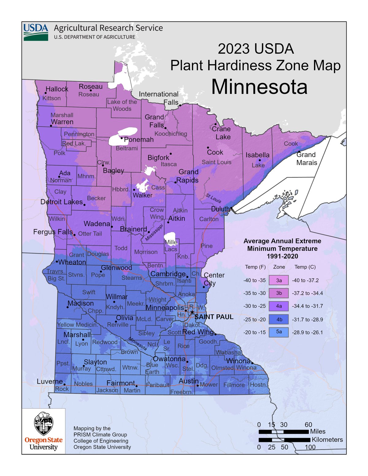 USDA Plant Hardiness Zone Map for Minnesota, showing Zones 3a through 5a. Source: USDA Agricultural Research Service (public domain).
If you have ever bought a perennial plant at a garden center, you have probably seen a label that says something like "Hardy to Zone 4." What does that mean?
The USDA Plant Hardiness Zone Map divides North America into zones based on the average annual extreme minimum temperature. Each zone represents a 10-degree Fahrenheit range. The zones tell you whether a perennial plant can survive winter in your area.
How Zones Work
The system is straightforward:
- Lower zone numbers mean colder winters
- Higher zone numbers mean milder winters
- Each zone is further divided into "a" (colder half) and "b" (warmer half), representing a 5-degree difference
For example, Zone 4a has average minimum temperatures of -30 to -25 degrees Fahrenheit. Zone 4b has average minimums of -25 to -20 degrees.
A plant labeled "Hardy to Zone 4" can survive winter temperatures as low as -30 degrees Fahrenheit. If you live in Zone 3, that plant may not survive your coldest winters.
Key Insight
Let's explore the prairie! Hardiness zones tell you the coldest temperature
a plant can survive — but they don't tell you everything. A plant might be
zone-hardy but still fail if your soil is wrong, your site is too shady, or
summer rainfall is insufficient. Always consider the full picture.
Zones 3a Through 5a
Minnesota spans USDA Hardiness Zones 3a through 5a. That range represents a significant difference in winter cold — from -40 degrees Fahrenheit in the far north to -15 degrees in the southeastern corner.
The chart below summarizes Minnesota's hardiness zones from coldest in the north to warmest in the southeast.
flowchart TD
    subgraph zones["Minnesota USDA Hardiness Zones (North → South)"]
        Z3A["Zone 3a: -40 to -35 F<br/>International Falls, Boundary Waters<br/>90-110 frost-free days"]
        Z3B["Zone 3b: -35 to -30 F<br/>Bemidji, Grand Rapids, Duluth<br/>110-130 frost-free days"]
        Z4A["Zone 4a: -30 to -25 F<br/>St. Cloud, Brainerd, Western Prairie<br/>130-145 frost-free days"]
        Z4B["Zone 4b: -25 to -20 F<br/>Twin Cities, Mankato<br/>140-155 frost-free days"]
        Z5A["Zone 5a: -20 to -15 F<br/>Rochester, Winona, SE Bluffs<br/>150-170 frost-free days"]
    end

    Z3A --> Z3B --> Z4A --> Z4B --> Z5A

    style Z3A fill:#E1BEE7,color:#000
    style Z3B fill:#BBDEFB,color:#000
    style Z4A fill:#B3E5FC,color:#000
    style Z4B fill:#C8E6C9,color:#000
    style Z5A fill:#FFECB3,color:#000
Use this interactive tool to look up the USDA hardiness zone for any Minnesota location and see which native plants are recommended for that zone.
Hardiness Zone Lookup
Type: microsim
Learning Objective: Students will be able to determine the USDA hardiness zone for a given Minnesota location and identify native plants suited to that zone's temperature extremes.
Controls: - Text input for zip code lookup - Clickable map of Minnesota for point-based lookup - Dropdown to filter recommended plants by type (grasses, wildflowers, shrubs, trees)
Visual Elements: - Minnesota map color-coded by hardiness zone (3a through 5a) - Selected location marker on the map - Zone information panel showing temperature range and frost-free days - Scrollable list of recommended native plants for the selected zone
Behavior: - Entering a zip code or clicking the map highlights the corresponding zone and displays zone details - The plant list updates to show species hardy to the selected zone - Clicking a plant name shows a brief profile with bloom time and habitat preferences
Instructional Rationale: Personalizing the hardiness zone concept to the student's own location makes the abstract zone system immediately practical and motivates plant selection decisions grounded in real conditions.
Zone 3a (-40 to -35 degrees F)
Zone 3a covers the far northern tier of Minnesota, including International Falls, Roseau, and the Boundary Waters region. This is some of the coldest territory in the lower 48 states. Plants here must tolerate extreme cold, short growing seasons, and heavy snow loads.
Native plants well suited to Zone 3a:
- White Spruce, Balsam Fir, Paper Birch
- Wild Blueberry, Bunchberry, Large-leaved Aster
- Native sedges and boreal wildflowers
Zone 3b (-35 to -30 degrees F)
Zone 3b covers much of northern Minnesota, including Bemidji, Grand Rapids, and Duluth. Conditions are still very cold, but the growing season is slightly longer.
Zone 4a (-30 to -25 degrees F)
Zone 4a covers a broad swath of central Minnesota, including St. Cloud, Brainerd, and much of the western prairie region. The majority of Minnesota's population lives in Zones 4a and 4b.
Zone 4b (-25 to -20 degrees F)
Zone 4b covers the Twin Cities metro area, Mankato, and surrounding regions. This is the most commonly referenced zone for Twin Cities gardeners. Most Minnesota native plants are hardy to at least Zone 4b.
Zone 5a (-20 to -15 degrees F)
Zone 5a is limited to a small area in extreme southeastern Minnesota, near Rochester, Winona, and along the Mississippi River bluffs. The river valley moderates winter cold, and the bluffs provide shelter from wind. Gardeners here can grow a few species that would not survive farther north.
Growing Season Length
The growing season is the number of days between the last spring frost and the first fall frost. This determines how long warm-season plants have to grow, flower, and set seed.
Minnesota's growing season varies dramatically:
- Northern Minnesota (Zone 3a): approximately 90 to 110 frost-free days. The last spring frost may not arrive until late May, and the first fall frost can come in early September.
- Central Minnesota (Zones 4a-4b): approximately 130 to 150 frost-free days. The Twin Cities typically sees its last spring frost around May 10 and first fall frost around October 5.
- Southern Minnesota (Zones 4b-5a): approximately 150 to 170 frost-free days. Rochester and the far southeast enjoy the longest growing season in the state.
What This Means for Native Plants
Minnesota's native plants have evolved to complete their life cycles within the local growing season. A prairie plant from the southwest part of the state may flower and set seed on a schedule tuned to a 160-day growing season. If you move that same species to a garden near Duluth with a 120-day season, it may not have time to fully mature.
This is why sourcing plants and seeds from local ecotypes — populations adapted to your specific region — matters. A Big Bluestem grown from seed collected in Goodhue County will perform better in a Twin Cities garden than one from seed collected in Kansas.
Bree's Tip
Every plant has a story! When buying native plants or seeds, ask your
supplier about seed origin. Reputable native plant nurseries in Minnesota
track the geographic source of their seed and can help you choose plants
adapted to your growing season.
Minnesota Soil Types
Soil is the foundation of every garden and every natural plant community. Understanding your soil helps you choose the right native plants and set realistic expectations for what will grow.
How Minnesota's Soils Formed
Minnesota's soils were shaped primarily by glaciers. Over the past two million years, massive ice sheets advanced and retreated across the state multiple times, grinding bedrock, depositing sediments, and carving lake basins. The result is a complex patchwork of soil types.
Major Soil Categories
Minnesota has several major soil types that correspond to its ecoregions:
- Prairie soils (Mollisols) — Deep, dark, nutrient-rich soils formed under thousands of years of prairie grass growth. These soils are found across western and southern Minnesota and are among the most fertile in the world. They are typically loamy with high organic matter.
- Forest soils (Alfisols) — Lighter-colored, moderately fertile soils formed under deciduous forest. Found across central and southeastern Minnesota. These soils have a distinct layer structure and moderate organic content.
- Boreal soils (Spodosols and Histosols) — Thin, acidic, sandy soils in the northeast, often over bedrock. Northern peatland soils (Histosols) are composed largely of partially decomposed plant material and can be many feet deep.
- Sandy soils (Entisols) — Found in areas like the Anoka Sand Plain north of the Twin Cities and parts of central Minnesota. These well-drained soils dry out quickly and support dry prairie and oak savanna communities.
- Clay soils — Heavy, poorly drained soils found in parts of the Red River Valley and in glacial lake beds. These soils hold water well but can be difficult to work and are slow to warm in spring.
Soil and Plant Selection
Matching plants to your soil type is just as important as matching them to your hardiness zone:
- Sandy soils suit drought-tolerant prairie species like Prairie Dropseed, Butterfly Milkweed (Asclepias tuberosa), and Pasque Flower (Anemone patens)
- Clay soils suit moisture-tolerant species like Blue Flag Iris (Iris versicolor), Joe Pye Weed (Eutrochium maculatum), and Swamp Milkweed (Asclepias incarnata)
- Rich loam supports the widest variety of native plants, from prairie wildflowers to woodland species
- Acidic, sandy soils in the northeast support blueberries, ferns, and boreal wildflowers
A simple soil test from your local University of Minnesota Extension office can tell you your soil's texture, pH, and nutrient levels. This is one of the most valuable steps you can take before planting.
Look Up Your Actual Soil — Free, Five Minutes
The USDA Natural Resources Conservation Service publishes a parcel-level soil survey for nearly every property in the United States. You can pull a detailed soil report for your own yard in about five minutes:
- Go to USDA Web Soil Survey
- Click Start WSS, then enter your street address
- Use the AOI (Area of Interest) tool to draw a rectangle around your yard
- Click the Soil Map tab — each colored area is a different soil map unit, named (e.g., "HsB — Hayden loam, 2 to 6 percent slopes")
- Click any unit name to see properties: parent material, drainage class, available water capacity, depth to bedrock, common uses
This single lookup tells you more than any plant tag. A Minneapolis suburb with "Hayden loam" or "Lester loam" supports completely different native plant communities than a north-shore yard with "Cathro muck" or sandy "Mahtomedi" soils. Match your plants to what's actually under your feet.
Bree's Tip
The Web Soil Survey also lets you generate a printable PDF report
of your parcel's soil — bring it along when you visit a native
nursery or talk to a designer. It signals you've done your homework.
Find What Grew Here Before 1850 — The Marschner Map
Between 1929 and 1931, geographer Francis Marschner reconstructed Minnesota's pre-settlement vegetation from the original 1850s Public Land Survey notes. The result — the Marschner map — is the single best reference for "what plant community would have existed on this exact spot before European settlement."
Browse it at the Minnesota Natural Resource Atlas — Pre-settlement Vegetation. Type in any address and the map shows your parcel's historic community: bur oak savanna, tallgrass prairie, big woods (maple-basswood forest), tamarack swamp, white pine forest, and so on.
This is genuinely useful for design. If your parcel was historically bur oak savanna, restoring a small pocket of savanna vegetation isn't just "planting natives" — it's literally repairing a fragment of the ecosystem that belongs there. The Marschner classification also tells you what soils, hydrology, and fire regime your community evolved with, all of which inform plant selection.
Key Insight
Combining your USDA soil survey result with the Marschner pre-
settlement community gives you the strongest possible answer to
"what should I plant here?" — soil + history + climate, all
pointing in the same direction.
Chapter Summary
Wonderful Progress!
 Let's grow together! You now have a solid understanding of Minnesota's
landscape — its ecoregions, climate zones, growing seasons, and soils. This
knowledge is your compass for choosing the right native plants for your
specific corner of the state.
In this chapter, you learned:
- Minnesota contains four major ecoregions: tallgrass prairie, deciduous forest, coniferous forest, and the prairie-forest border
- The tallgrass prairie once covered 18 million acres but less than 2% remains today
- Deciduous forests are defined by broadleaf trees that drop their leaves each fall
- Coniferous forests in the northeast feature evergreen trees adapted to harsh, cold conditions
- The prairie-forest border is a dynamic transition zone — especially relevant for Twin Cities gardeners
- Minnesota has diverse wetland types including marshes, bogs, fens, and swamps
- USDA Hardiness Zones indicate the coldest temperatures a plant can survive
- Minnesota spans Zones 3a through 5a, from -40 to -15 degrees Fahrenheit minimum temperatures
- Growing season length ranges from 90 days in the north to 170 days in the southeast
- Minnesota's soil types were shaped by glaciers and vary from rich prairie loams to thin boreal sands
Concepts Covered
This chapter covers the following 10 concepts from the learning graph:
- Minnesota Ecoregions
- Tallgrass Prairie Region
- Deciduous Forest Region
- Coniferous Forest Region
- Prairie-Forest Border
- Minnesota Wetland Types
- USDA Hardiness Zones
- Zones 3a Through 5a
- Growing Season Length
- Minnesota Soil Types
Prerequisites
This chapter builds on the foundational concepts from Chapter 1: Introduction to Native Plants and Ecology. You should be comfortable with the definitions of native plants, ecosystems, biodiversity, and habitat before proceeding.
What's Next
In Chapter 3, we'll dive into the plants of Minnesota's prairies and grasslands — the wildflowers, grasses, and forbs that make up one of the most beautiful and ecologically important plant communities on the continent.
Image Credits
- Ecoregion map: U.S. Environmental Protection Agency, Level III Ecoregions of Minnesota (public domain)
- Tallgrass prairie photo: Jennifer Briggs / USFWS Mountain-Prairie (CC BY 2.0)
- Deciduous forest photo: Wikimedia Commons contributor (CC BY-SA 2.0)
- Boreal forest photo: U.S. Forest Service (public domain)
- USDA Hardiness Zone map: USDA Agricultural Research Service, 2023 Plant Hardiness Zone Map (public domain)